The Faroe Islands are known for their rough wild nature full of waterfalls, cliffs, and stunning views. Even though this country is kind of small there is still a lot of hikes. It sounds like a good deal doesn’t it? The best thing about these places is that all the hikes have different difficulties so there is something for everyone. I spend a whole week in the Faroe Islands and managed to hike in a lot of places. Here is my count of best hikes in the Faroe Islands.
Best hikes in the Faroe Islands
Table of Contents
Since there is a lot of hikes around Faroe Island, I decided to show you my most favorite ones. I was trying to get here the level of difficulty and the fees for hikes. Yes, you need to pay hiking fees on the Faroe Islands. Unfortunately. But for the views, it is worth it. Besides those fees are usually used for cleaning nature and generally just making the trails better.
When you are hiking in the Faroe Islands, you can expect a lot of different kinds of hiking trails. While some of them are maintained and basically feel like a road. There are also some others that are just in the middle of nature with no clear path and markings on where should you go next. I decided to mention all of them since they are all pretty beautiful.
Troll woman finger hike (Trollkonufingur)
Difficulty: Easy
Hiking Fee: None
Length: From the Sandavagur village to the view, it is about 3 km
About the hike: Trollkonufingur is quite easy to hike with one simple goal. To see a cliff that is shaped like a Troll woman’s finger. And see the other ending of the fjord. The path that will lead you there is also very easy to follow since there is a lot of farming facilities around it and people are using the path to get to their farm animals, very often in a car.
That said it also means that you will see a lot of farm animals around once you get there. Sheep is quite normal, this time, you will also see some goats, ponies, and geese. Don’t worry, all of them are closed in their pastures.
There is also one section of the path when you will have to go through a sheep pasture. There will be doors to get in and out. To maintain a good relationship for the rest of the tourists, make sure you close the doors properly, otherwise, the sheep might run away. On the last part of the path, you can see that it is clearly made for tourists since the path is very well maintained but also there are trashcans alongside the path. Which is very helpful, to be honest. We all need to snack and now we have a place where to put the trash from the snacks.
A little bit more about the difficulty. While the path is well maintained which means that there are no bigger obstacles on the road, when you go to the view, you will need to go up the hill. It is not too steep, but if you are not fit, you will probably lose your breath. But that is really the only difficult part of the path.
How to get to the hike start?

The hike itself is on the island of Vagar. So if you are located in Vagar, it is quite easy to get there. But if you have accommodation in Torshavn, you will need to hop on a bus and get to the village called Sandavagur. Just take the bus that goes to the airport. It is the same one and it stops in a lot of places. In Sandavagur make sure you will get out on the first possible stop in the village. It is closest to the beginning of the hike.
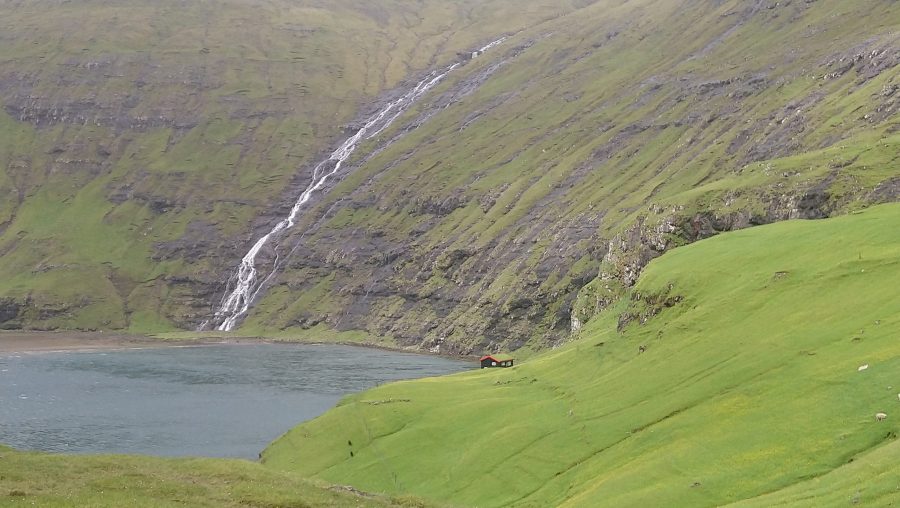
Tjornuvík to Saksun

Difficulty: Medium
Hiking fee: None
Length: 7 km
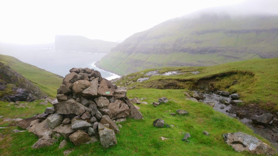
About the hike: The hike from Saksun to Tjornuvík is very famous and everyone who has ever visited the Faroe Islands heard about it. That said, it is not for everyone. The difficulty is medium at best. When you are hiking this trail, some places are not marked clearly on where to go next, so you might get lost for a little bit.
Since it is a hike where you go through mountains, the trail isn’t maintained too much and so you need to prepare really good hiking shoes to be able to go through it. Make sure that they are waterproof as well because on several occasions you will need to cross a couple of springs and even though there isn’t too much water in them, your feet would still get wet otherwise.
On this hike, you would encounter slightly different terrains. Rocky hills, green pastures, and some small fields. The parts where you hike up and down from the mountains are a big part of this hike. And they are pretty steep, so make sure that you are fit enough to do that. Once you are up in the mountains, you will meet a wild wind and a path, where you just cannot hide. It might sound horrific but if you dress for it properly, it will be no problem.
The villages are both really worth visiting. Both Saksun and Tjornuvík are really nice and interesting places and they are really old. Both of them look really different so you won’t get bored with the same views.
How to get to the hike?

It is a little bit of a hassle. If you want to hike from Saksun to Tjornuvík, you might need to hitchhike or get a car that would drive you to Saksun because there is no public transport to the village. If you are plan to do it the other way around from Tjornuvík to Saksun, there is a bus from Torshavn, that goes to Oyrarbakki and there you can catch a direct bus to Tjornuvík. The bus to Tjornuvík is usually waiting for the one from Torshavn, so there shouldn’t be an issue of catching it.
Kalsoy lighthouse hike
View this post on Instagram
Difficulty: Medium
Hiking fee: None
Length: 4 km
About the hike: Hike to Kalsoy lighthouse is one of the most iconic ones that there is. Certainly one of the best hikes in the Faroe Islands. Kalsoy is one of the smaller islands with a really low population. But you can always catch a ferry there from Klaksvík and then get a bus to the last village of this island.
You would hike to a lighthouse around the highest cliff in the Faroe Islands. The road isn’t maintained and so you have to rely on the path that is made by other people and sheep. Which is quite fine for most of the way. But be prepared for jumping over little springs, steep hill, and really high cliff. Which makes the hike significantly more difficult. So make sure you are prepared for it. Once you reach the lighthouse, you will face wind from all sides.
However, the view is certainly worth it. It is one of the most beautiful views on the islands. But here is the twist. When you go there, make sure that the weather is actually good. It is the highest cliff on the island and so it is really easy for clouds to stuck on it. So you need really good weather. Not only so you can actually see the view but also if it is windy, it will get really dangerous to hike around the cliff. There is nothing to catch on so it can be very dangerous. So be careful when you are going.
How to get to the hike

If you are in Torshavn, you can catch a direct bus to Klaksvík. There is a couple of them going in the morning. The bus will get you all the way to the ferry, that you have to use to get to Kalsoy island. You can even get there by car. But then you would pay a special fee. Once you are in Kalsoy, you can drive with a car to the last village called Trollanes. If you don’t have a car, you can catch a bus that would get you to the village.
Hike to the lighthouse in Mykines

Difficulty: Easy
Hiking fee: 250 dkk
Length: 4 km
About the hike: This hike in the Faroe Islands isn’t only good if you like hiking, it is one of the best hikes in Faroe Island if you want to see puffins. Especially in summer, puffins are dominant in this little island not too far from Vagar airport. The hike is one of the few on the Faroe Islands where you will need to pay a hiking fee. It is mainly to limit people who would come here. Not that locals aren’t happy about the tourist but to protect the population of puffins.
The hike starts right before you enter the village. In fact, there is a big map, that would show you the hike and that is where you know that this is the hike. The start of it is basically a steep hill that you need to hike up. But it is the only steep part of the hike that you will encounter on this trail. Other places might have steep hills too, but not as steep and not as long.
The path is nicely maintained so you know where to go for the most of the road without any issues. Some parts have even stairs and handlers so you can help yourself both up and down.
Mykines hike is really a beauty. Especially because of the puffins. But make sure that you would not go outside of the road so you wouldn’t step on their nests. I made a whole guide on this island and it’s puffins right here, where you can find some more information.
How to get to Mykines

There are two main ways on how to get there. The first one is to jump on a ferry. It is a more popular way to do it. But you need to book the tour ahead on this website. You can get on the ferry with a bus from Torshavn. There is a bus stop right next to the ferry, so it is easy to get there. Another way would be to get there by helicopter. That is relatively cheap but the seats are very limited.
Gasadalur

Difficulty: Easy/difficult
Hiking fee: None
Length: 500 m to 5 km
About the hike: Gasadalur is one of the dominants of the Vagar island on the Faroe Islands and definitely one of the best hikes here as well. But there are two options for hiking to this waterfall. One of them is significantly shorter than the other. The main hike is only around the Gasadalur village with stunning views around it as well. But it doesn’t take such a long time and generally, it is not difficult at all.
The second option for hiking here is to hike the old postal road that people used to use for getting to and from the village before there was a tunnel under the mountains. This path leads both up and down the hill and it is significantly more difficult than just hiking around the village in the valley. You would also need an offline map to make sure that you are on the right trail.
Either way, both ways you will get to see a cozy little village with the famous waterfall.
How to get to Gasadalur?

This is perhaps the biggest problem of the hike. There is no public transport to the village. The last village where you can get by bus is Sorvagur. So if you are not renting a car, you will either have to go by walk 10 km from the first village. Otherwise, you can always try hitchhiking. It is quite popular on the Faroe Islands.
Hike around the lake above the ocean

Difficulty: Easy
Hiking fee: 200 dkk
Length: 3 km
About the hike: Lake above the ocean is one of the most famous places in the Faroe Islands in general. It is the biggest lake in this little country and there is a hiking trail around it. The trail is well-maintained and you will clearly see where to go. There is also a clear spot where you can take the picture of the famous view.
Unfortunately, this hiking trail does have a hiking fee. It is mainly so the owners of the pastures where the hike is can take care of the nature that can get demolished with more tourists that are coming here every year. They are working on a hike for quite some time now.
How to get to the lake above the ocean

Once again, you will have to take a bus to Vagar island. There is a village called Midtvagur. At the end of this village, where the last bus stop is, you can get off the bus and get on the hiking trail. Once you are there, you will probably meet a little hut where you will need to pay the hiking fee. If you are renting a car, there is a parking lot nearby or you can park your car at the supermarkets close to the bus station.
Best hikes on Faroe Islands – practical info

- Make sure you have a lot of water with you when you are hiking. Some of the hikes get longer than expected
- You should also pack windproof and waterproof clothes, the weather in the Faroe Islands is rarely nice and sunny
- In any case, you need to have really good shoes. Some of the trails are more maintained than others
- When you are hiking, respect the pastures. You will be entering private property and it would be really bad to keep trash there or keep the doors for sheep open. Also potentially dangerous for the sheep
Like it? Pin it for later!


I cannot wait to get to the Faroe Islands. Though it seems a bit of a mix of Norway and Iceland, I’m sure it’s a world onto itself. Thanks for the great hiking ideas and hopefully I can get there soon!
I love lighthouses so I’m very interested in the Hike to the lighthouse in Mykines! Thanks for sharing all the great tips & info!
I’ve recently fallen in love with hicking since COVID had so many restrictions. I will add this to my list of places I can hike when we are able to travel again. Thanks so much for sharing!
Gosh, what a stunning destination for hiking! I’d love to get there one day.
I think I wouldn’t even know which hike of them to choose! All look truly incredible – I mean it’s no wonder, Faroe Islands have the most beautiful landscape!
I loved this post! This is a bucket list trip for me 🙂 thanks for sharing!
I need to get to Faroe Islands – these hikes look incredible. That lake above the ocean is just, wow! Looks beautiful. I’m definitely up for the lighthouse hike too.
Faroe Islands are definitely a place I dream of going…for all of this stunning scenery. Great tips!
Wow! Faroe Island looks incredible. I’m pinning for later and definitely gonna plan a trip to see these beautiful hikes. Thank you for sharing!
The Faroe islands look like the have come right out of a midieval story with the water and even the overcast! We would make the trek just to see the stunning cliff.
I can see why all of these hikes are your favorite as they all look phenomenal! I don’t think I could pick one. Lol. I would want to hike all of them as they each have stunning and unique landscapes. The women’s finger, the lighthouses and the lake by the ocean would be incredible to see and like how none of them are too difficult.
This looks amazing! Adding this to the bucket list for sure